The Char Dham Yatra in Uttarakhand is one of India's most significant pilgrimage circuits, covering four high-altitude Himalayan shrines: Yamunotri, Gangotri, Kedarnath, and Badrinath. Navigating this terrain requires precise logistical planning due to the challenging geographical conditions, variable road connectivity, and high-altitude trekking requirements.
A factual understanding of the route map is essential for ensuring safety and timely completion of the circuit. This guide focuses strictly on the geographic layout, road distances, trekking points, and transport connectivity required for a successful journey.
Char Dham Yatra Route Overview
The Char Dham Yatra follows a traditional clockwise sequence (Parikrama), starting from the west and moving towards the east. This order is not just traditional but also practical for gradual altitude acclimatization.
- Start/End Point: Haridwar or Rishikesh.
- Direction: Yamunotri → Gangotri → Kedarnath → Badrinath.
- Total Road Distance: Approximately 1,350 km to 1,600 km (round trip from Haridwar).
- Terrain: National Highways (NH 34, NH 134, NH 107, and NH 7) and steep mountain roads.
Char Dham Yatra Route Map – Overview
The following table outlines the primary transit hubs and the nature of the approach to each shrine.
|
Sequence |
Dham |
Nearest Major Town |
Road Head (Last Point) |
Trek Distance |
|
1 |
Janki Chatti |
6 km |
||
|
2 |
Gangotri |
No Trek (Motorable) |
||
|
3 |
Gaurikund |
16–18 km |
||
|
4 |
Badrinath |
No Trek (Motorable) |
Char Dham Yatra Route Map from Haridwar (Step-by-Step)
The journey is typically divided into sections based on overnight halts and the distance between the shrines.
Haridwar to Yamunotri (The First Leg)
- Route: Haridwar → Dehradun → Mussoorie → Kempty Fall → Barkot → Janki Chatti.
- Logistics: Most pilgrims halt at Barkot (1,220m elevation). From Barkot, a 45 km drive leads to Janki Chatti, which serves as the base for the Yamunotri trek.
- Trek: A 6 km paved uphill climb to the Yamunotri temple.
Barkot to Gangotri
- Route: Barkot → Radi Top → Uttarkashi → Harsil → Gangotri.
- Logistics: The route passes through the scenic Harsil valley. Uttarkashi is the major administrative hub here.
- Road Head: Vehicles go directly to the temple gates at Gangotri.
Uttarkashi to Kedarnath
- Route: Uttarkashi → Tehri → Srinagar → Augustmuni → Guptkashi → Sonprayag → Gaurikund.
- Logistics: This is the longest transit day. From Sonprayag, only local shuttle jeeps are allowed to reach Gaurikund (5 km).
- Trek: The 16–18 km trek to Kedarnath begins at Gaurikund.
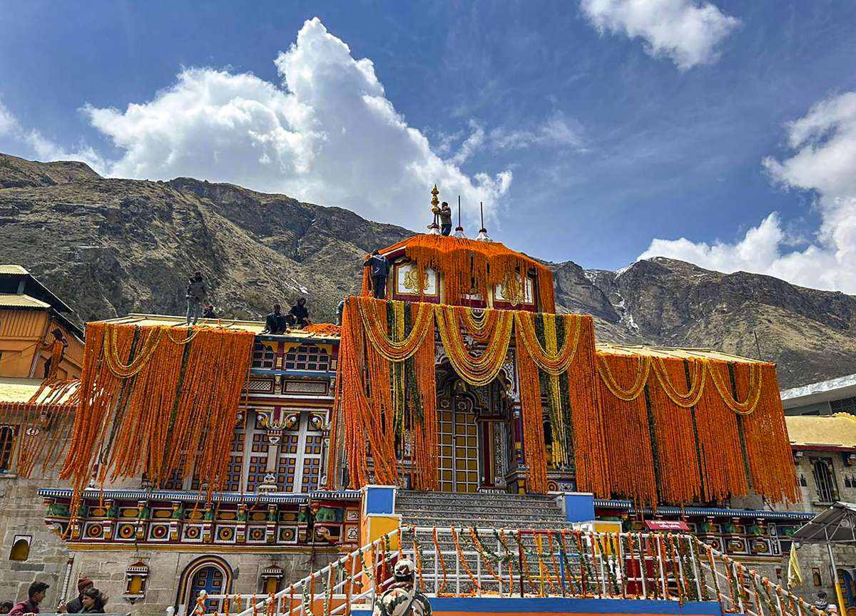
Kedarnath to Badrinath
- Route: Kedarnath (Trek down) → Gaurikund → Sonprayag → Guptkashi → Chopta → Gopeshwar → Joshimath → Badrinath.
- Logistics: The route via Chopta (the "Mandal-Chopta road") is highly scenic but can be narrow. Joshimath is the final major town before Badrinath.
Badrinath to Haridwar (The Return Leg)
- Route: Badrinath → Joshimath → Chamoli → Karnaprayag → Rudraprayag → Srinagar → Rishikesh → Haridwar.
- Logistics: This involves a long descent along the Alaknanda River via the Panch Prayag (confluences).
Char Dham Yatra Distance Chart
Distances are approximate and can vary slightly based on road diversions or landslides.
|
Route Section |
Distance (km) |
Approx. Travel Time |
|
Haridwar – Barkot |
200 km |
7–8 Hours |
|
Barkot – Janki Chatti |
45 km |
2 Hours |
|
Janki Chatti – Yamunotri (Trek) |
6 km |
3–4 Hours (one way) |
|
Barkot – Uttarkashi |
82 km |
4 Hours |
|
Uttarkashi – Gangotri |
100 km |
4–5 Hours |
|
Uttarkashi – Guptkashi |
200 km |
8–9 Hours |
|
Gaurikund – Kedarnath (Trek) |
16–18 km |
7–10 Hours (one way) |
|
Guptkashi – Badrinath |
190 km |
7–8 Hours |
|
Badrinath – Haridwar |
310 km |
10–12 Hours |
Trekking Route Map Details
Two of the four shrines require physical trekking. Understanding the elevation and rest points is crucial for stamina management.
Yamunotri Trek Route (6 km)
- Base: Janki Chatti.
- Path: Paved, steep incline.
- Intermediate Points: Phool Chatti (midway).
- Services: Ponies, Palkis (palanquins), and Pitthus (porters) are available at the Janki Chatti stand.
Kedarnath Trek Route (16–18 km)
Following the 2013 floods, a new trekking path was established. It is significantly longer and steeper than the old route.
- Base: Gaurikund.
- Primary Waypoints:
- Gaurikund to Jungle Chatti (4 km): Initial steep climb.
- Jungle Chatti to Bheembali (3 km): Gradual ascent.
- Bheembali to Linchauli (4 km): High altitude gain; medical camps available here.
- Linchauli to Kedarnath Base Camp (4 km): Steepest section before leveling out near the temple.
- Infrastructure: The route features rain shelters, bio-toilets, and oxygen facilities at Linchauli and Bheembali.
Road Conditions and Transport Types
The Char Dham All-Weather Road Project has significantly widened most sections, but certain patches remain sensitive.
Vehicle Suitability
- Private Taxi: Sedans are acceptable for 2-3 people, but SUVs (Innova, Bolero) are recommended for better ground clearance.
- Tempo Traveller: Ideal for groups of 10–12. Best for the Haridwar-Barkot-Badrinath circuit.
- Buses: GMOU (Garhwal Motor Owners' Union) and UTC (Uttarakhand Transport Corporation) operate regular services.
- Self-Drive: Not recommended for those inexperienced with high-gradient mountain hairpins and single-lane traffic.
Hazard Zones
- Landslide Prone Areas: Lambagarh (near Badrinath), Kaliasaur (between Srinagar and Rudraprayag), and the stretch near Sonprayag during heavy rains.
Char Dham Yatra Route Map by Helicopter
For pilgrims with time constraints or physical limitations, helicopter services provide an alternative.
|
Feature |
Road Route |
Helicopter Route |
|
Duration |
10–12 Days |
2–5 Days |
|
Landing Points |
N/A |
Sahastradhara (Dehradun), Phata, Sersi, Guptkashi |
|
Trek Required |
Yes (Yamunotri & Kedarnath) |
Minimal (Only for Yamunotri if flying from Dehradun) |
|
Reliability |
High (Except in Monsoon) |
Dependent on Weather/Visibility |
Note: Kedarnath shuttle flights operate from Phata, Sersi, and Guptkashi. Badrinath has a dedicated helipad near the temple.
Price Details Per Person
|
S.No |
No Of Pax |
Standard |
Deluxe |
Luxury |
Vehicle |
|
1 |
02 Pax |
42,000/- |
47,000/- |
54,000/- |
Vehicle Dezire (Non A/C on Hils) |
|
2 |
04 Pax |
31,000/- |
37,000/ |
44,000/ |
Vehicle Dezire (Non A/C on Hills) |
|
3 |
04 Pax |
36,000/- |
42,000/- |
49,100/- |
Innova Crysta A/C (Non A/c on Hills) |
|
4 |
06 Pax |
31,000/- |
37,500/- |
45,000/- |
Innova Crysta A/C (Non A/c on Hills) |
|
5 |
08 Pax |
30,500/- |
37,000/- |
44,500/- |
12 Seated Tempo ( Non A/c on Hills) |
|
6 |
10 Pax |
28,000/- |
35,500/- |
42,500/- |
12 Seated Tempo ( Non A/c on Hills) |
|
7 |
12 Pax |
27,500/- |
34,000/- |
41,000/- |
12 Seated Tempo ( Non A/c on Hills) |
|
8 |
14 Pax |
27,200/- |
33,700/- |
40,800/- |
16 Seated Tempo ( Non A/c on Hills) |
|
9 |
16 Pax |
26,500/- |
37,000/- |
40,000/- |
16 Seated Tempo ( Non A/c on Hills) |
Hotels Details Of Char Dham Yatra 2026
|
SR. No |
Destination |
Standard Room |
Deluxe |
Luxury |
|
1 |
02 Barkot |
Hotel Chandralok/ Hotel 7 Oaks/ CJ Resort |
Raturi Estate / Camp Advanta – ( Tent Stay ) |
Monkey Tail Camp Veda Camp Or Similar |
|
2 |
02 Uttarkashi |
Hotel Shiv Ganga view/Ganga
|
River View Resort / Ganga Valley Resort |
The Great Ganga / Akash Ganga |
|
3 |
01
|
Hotel Shivay inn/ Hotel shivoyà/Hotel priya |
Amritara Sun Inn / Himalayan
|
Charmachan/ Villa Adhya |
|
4 |
01 Kedarnath |
Sitapur House/ Aggarwal Bhawan |
Sharing dormitory as per
|
Sharing dormitory as per availability or similar |
|
5 |
01
|
Hotel Shivay inn/ Hotel shivoyà/Hotel priya |
Amritara Sun Inn/ Himalayan
|
Charmachan/ Villa Adhya |
|
6 |
01 Badrinath |
Shloka inn / Hotel Shloka |
Lords Centric / Indra Ganga Inn |
New Snow Crest / Amritara Avadh |
|
7 |
01
|
Mantara palace/ Hotel CP residency/ Batallion 10 |
Tulip Resorts/Pride Rudraprayag or similar |
Monal Resort/ Riverside Resort Srinagar or similar |
Best Time to Follow the Route
The Char Dham route is only accessible for approximately six months a year (May to October/November).
- Peak Season (May–June): Best weather, but maximum congestion on roads and long wait times at shrines.
- Monsoon (July–August): Not recommended. High risk of landslides, road blockages, and cloudbursts. Trekking paths become slippery.
- Post-Monsoon (September–October): Clearer skies and less crowded. Temperatures drop significantly, especially at Kedarnath and Badrinath.
Common Route Mistakes to Avoid
- Incorrect Sequence: Attempting Gangotri before Yamunotri can lead to altitude sickness as the elevation gain is not gradual.
- Ignoring Night Driving Bans: For safety, driving on hill roads in Uttarakhand is generally prohibited after 8:00 PM and before 4:00 AM.
- Underestimating the Kedarnath Trek: Many pilgrims attempt to trek up and down on the same day. Given the 18 km length, an overnight stay at the Kedarnath top is logistically safer.
- Skipping Biometric Registration: It is mandatory for all pilgrims to register online or at physical counters (Haridwar/Rishikesh) to track movement across the route.
Kedarnath Puja Details
|
Puja / Service |
Timing |
Rate (₹) |
Description |
|
Morning & Daytime Paths |
|||
|
Ved Path |
07:30–12:00 & 15:00–18:00 |
₹2,500/- |
Scripture chanting session |
|
Geeta Path |
₹2,500/- |
Bhagavad Gita recitation |
|
|
Evening Aarti / Puja / Path |
18:00–19:45 |
||
|
Kapoor Aarti |
18:00–18:10 |
₹201/- |
Traditional incense flame ceremony |
|
Chandi Aarti |
18:15–18:30 |
₹401/- |
Flame ceremony with Chandi offerings |
|
Swaran Aarti |
18:30–18:45 |
₹501/- |
Golden flame offering |
|
Astotari Puja |
18:45–19:00 |
₹401/- |
Puja with mantra recital |
|
Vishnusahastanam Path |
19:00–19:20 |
₹701/- |
Vishnu Sahasranama recital |
|
Vishnusahastranaamawali |
19:20–19:45 |
₹601/- |
Extended Vishnu Sahasranama chant |
|
Temple Closing Puja |
Uncertain timing |
||
|
Shayan Aarti with Geet Govind Path |
After evening rituals |
₹3,100/- |
Night prayer & devotional song chant |
Badrinath Puja Details
|
Puja Name |
Category |
Government Fee (₹) |
|
Mahabhishek Puja |
Morning Special Puja |
4700/- |
|
Abhishek Puja |
Morning Puja |
4500/- |
|
Veda Path |
Day Path |
2500/- |
|
Geeta Path |
Day Path |
2500/- |
|
Ashtotari Puja |
Evening Path |
401/- |
|
Vishnu Sahasranam Path |
Evening Path |
701/- |
|
Vishnu Sahasranamawali Path |
Evening Path |
601/- |
|
Shayan Aarti (Geet Govind Path) |
Night Puja |
3100/- |
|
Entire Day Puja |
Full Day Puja |
12000/- |
Route Map FAQs
Q: What is the correct Char Dham Yatra route order?
A: The traditional and most practical order is Yamunotri → Gangotri → Kedarnath → Badrinath.
Q: How many km is the Char Dham Yatra by road?
A: Starting and ending at Haridwar, the total road distance is roughly 1,350 km to 1,550 km depending on side trips.
Q: From where does the Kedarnath trek start?
A: The motorable road ends at Sonprayag. You take a local shuttle to Gaurikund, where the 16–18 km trek begins.
Q: Is the route safe for senior citizens?
A: Yes, provided they use ponies/palkis for treks and carry portable oxygen cylinders. A medical check-up is advised before the journey.
